
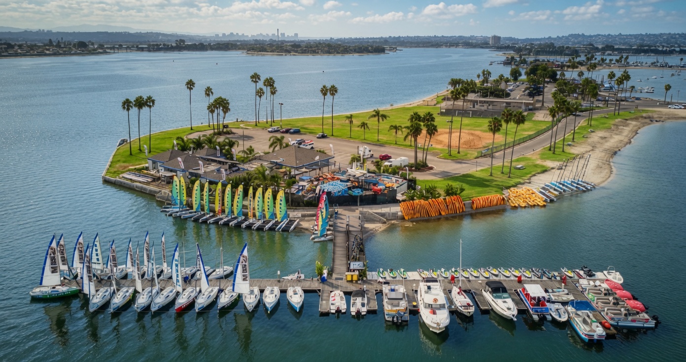
Explore Mission Bay, San Diego
Things to Do in Mission Bay, San Diego A Local Waterfront Guide
Find the right beach, park, path, viewpoint, or on-water activity for your day. Start with the map, compare the bay’s most useful areas, and build a visit that fits your people and pace.
Reviewed by Mission Bay Sportcenter’s waterfront team at Santa Clara Point · Updated September 2026
Best Mission Bay activities
Choose the kind of bay day you want.
Mission Bay can feel peaceful, social, breezy, or fast. These four starting points make it easier to match the activity to your group.
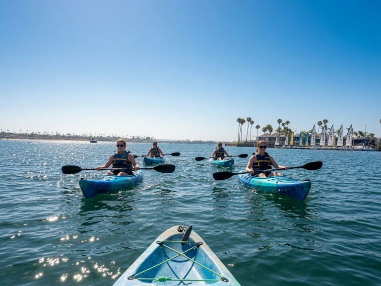
Paddle at your own pace
Choose a stable single or tandem kayak, or stand up on a paddleboard for a more active view of the shoreline. It is an approachable way to turn sightseeing into part of the day.
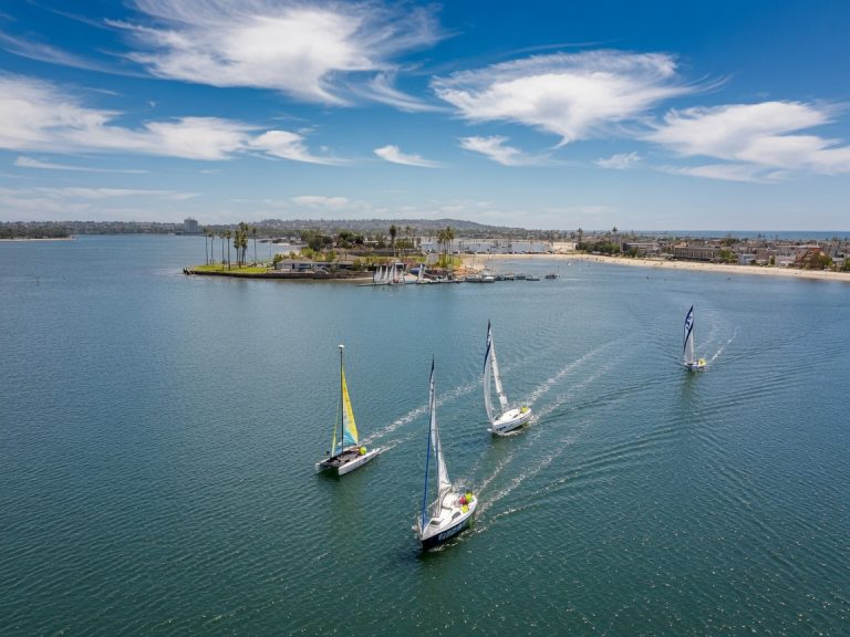
Catch the Mission Bay breeze
Sailing changes the pace of the day. Compare monohulls and catamarans, then choose the size and style that match your group and experience.
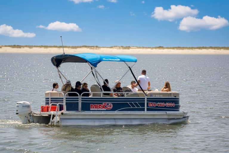
Cruise with your whole crew
A pontoon keeps friends or family together for relaxed sightseeing and conversation. It is the social choice when the group matters as much as the route.
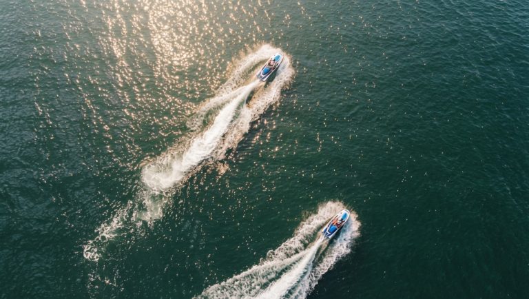
Add speed to the view
For a more energetic experience, a jet ski gives the bay a completely different personality. Every driver completes the required eligibility and safety process before departure.
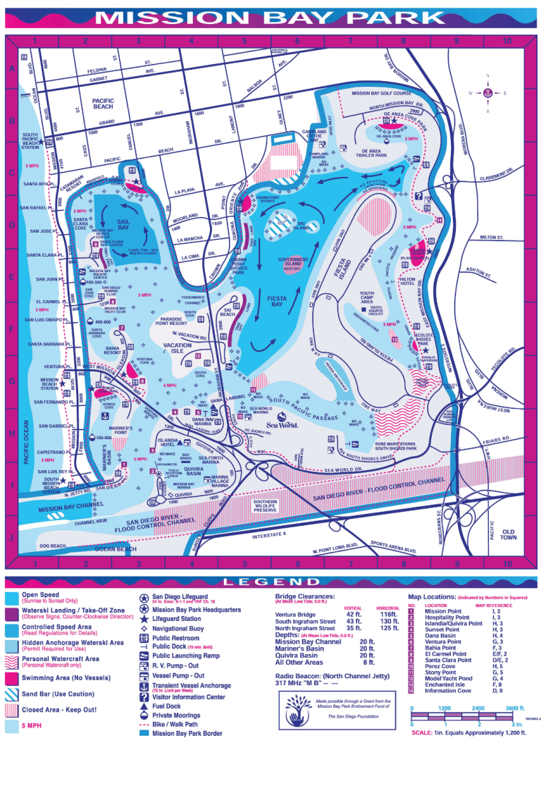
See the whole bay
One bay. Many different kinds of days.
Mission Bay is a network of coves, beaches, islands, paths, parks, and activity zones. Use the full map before you leave, then choose an area based on what you actually want to do.
Best areas to explore
Start with the shoreline that fits your plans.
These six areas are useful orientation points, not interchangeable beaches. Posted signs, seasonal staffing, parking conditions, and activity zones can change, so check the area when you arrive.
Santa Clara Point + Sail Bay
A west-side starting point close to Mission Beach and Pacific Beach, with paths, water views, and direct access to MBSC’s waterfront launch.
- Best for
- Rentals, paddling, sailing, and a beach-to-bay day
- Know before you go
- Parking around Sail Bay can be limited, especially at busy times
Crown Point
Broad lawns, a sandy shoreline, picnic facilities, long views across the water, and space for a relaxed family or group afternoon.
- Best for
- Picnics, walking, shoreline time, and open views
- Know before you go
- Swimming and lifeguard coverage are area-specific and seasonal
Vacation Isle + Ski Beach
A central mix of lawn, paths, playground space, picnic areas, boat access, and views into the channels that connect the bay.
- Best for
- Walking, picnics, boating activity, and central bay views
- Know before you go
- Swimming is not allowed at Ski Beach
De Anza Cove + Tecolote Shores
The north and east side combines paths, picnic space, play areas, water access, and a closer look at the bay’s evolving ecological edge.
- Best for
- Walking, cycling, playgrounds, picnics, and north-bay exploring
- Know before you go
- Facilities and lifeguard coverage vary by location and season
Fiesta Island
A more open, less manicured part of Mission Bay used for walking, cycling, events, broad shoreline views, and designated dog activity.
- Best for
- Long loops, big-sky views, dogs, and room to roam
- Know before you go
- No public restrooms are on the island; follow posted closures and rules
Bonita Cove + Mission Point
A family-friendly bridge between bay and beach, with playgrounds, picnic space, paths, water access, and convenient Mission Beach connections.
- Best for
- Families, casual walks, playground time, and sunset stops
- Know before you go
- Swim only where designated and follow current lifeguard guidance
Simple Mission Bay itineraries
Make the most of the time you have.
You do not need to circle the entire bay to have a good visit. Pick one main area and add one or two experiences around it.
Quick waterfront reset
Ideal when you want fresh air, a view, and one activity without turning the visit into a full production.
- Start at Santa Clara Point
- Choose a shoreline walk or one-hour paddle
- Finish with a Sail Bay view
Family bay afternoon
Mix active time with plenty of room for snacks, playgrounds, and an unhurried shoreline break.
- Pick Bonita Cove or Crown Point
- Add a tandem kayak or pontoon cruise
- Leave time for a picnic and sunset
See Mission Bay from land and water
Build the day around one longer rental, then use the map to add a park, path, or beach stop nearby.
- Book your main on-water experience
- Explore one new section of shoreline
- Close the day with a west-side sunset
Mission Bay shoreline activities
The adventure continues beyond the dock.
Walk, bike, picnic, spot wildlife, or stay for sunset. Mission Bay’s beaches, parks, and paths make it easy to add a shore-side chapter before or after your time on the water.
Walk the waterfront
Choose one section of shoreline instead of trying to cover every path in one visit.
Ride a shoreline path
Bike routes connect parks, viewpoints, and bridges across much of the bay.
Pack a picnic
Many park areas include lawns and tables, but amenities vary by location.
Stay for sunset
West-side viewpoints make it easy to pair a bay walk with golden-hour light.
Watch the shoreline
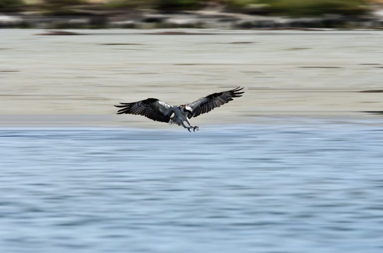
You may spot birds around quieter edges. Observe from a distance and avoid disturbing habitat.
Find a playground
Bonita Cove, Ski Beach, De Anza Cove, and other park areas offer family play options.
Understand the place
The bay is a playground and a living coastal system.
Mission Bay was developed from a tidal marsh historically known as False Bay. Its modern beaches, islands, channels, and parks were shaped through major development from the 1940s through the 1960s. Today, recreation sits beside eelgrass, wetlands, bird habitat, and active restoration planning.
Good visitors give wildlife room, keep trash out of the water, respect marked habitat, and follow the posted rules for each shoreline and activity zone.
Plan before you go
A few checks make the day easier.
Conditions, parking, posted restrictions, and seasonal services vary around a large public park. Confirm the details for the specific area you plan to use.
Parking and arrival
Many City-operated lots do not charge for parking, though they can fill early on busy days. For an MBSC rental, review parking and directions to Santa Clara Point.
Swimming
Use designated swimming areas and follow posted signs and lifeguard guidance. Coverage is location-specific and seasonal. Check City beach information.
Dogs and park rules
Fiesta Island includes a designated leash-free area. Rules differ elsewhere and can vary by time or season, so check posted signs and current City dog guidance.
Rental preparation
Arrival time, identification, waivers, and safety steps depend on the equipment. See what to expect before your rental.
Mission Bay questions
Quick answers before you explore.
What are the best things to do in Mission Bay, San Diego?
Popular options include kayaking, paddleboarding, sailing, pontoon cruising, jet skiing, walking or biking waterfront paths, picnicking, visiting playgrounds, watching the sunset, and exploring public beaches and shoreline parks. The best choice depends on your group, time, and preferred pace.
Which part of Mission Bay is best for first-time visitors?
Santa Clara Point and Sail Bay are convenient starting points for combining an on-water rental with a shoreline visit. Crown Point works well for lawns, picnics, and broad views. Bonita Cove and Mission Point are useful for families. Start with the Mission Bay map and choose one main area.
Is Mission Bay good for families?
Yes. Many areas combine lawns, sandy shoreline, picnic facilities, paths, and playgrounds. Amenities and swimming rules vary, so check the specific park area and posted guidance before settling in.
Can you walk or bike around Mission Bay?
Yes. Mission Bay includes an extensive network of paved waterfront paths, but you do not need to complete the entire loop. Choose a section near Crown Point, Sail Bay, Vacation Isle, Tecolote Shores, or another park area and build a route that fits your time.
Can you swim in Mission Bay?
The City identifies eight designated swimming areas around Mission Bay. Swimming is not allowed everywhere, including Ski Beach and Mariner’s Point. Use designated areas, follow posted signs, and choose locations with lifeguard coverage when available.
Where can I rent a kayak or paddleboard on Mission Bay?
Mission Bay Sportcenter rents single and tandem kayaks plus stand-up paddleboards from its waterfront location at 1010 Santa Clara Place. You can compare kayaks and paddleboards before choosing.
Are dogs allowed at Mission Bay?
Fiesta Island includes a designated leash-free area. Dog access at other beach and bay locations is restricted or time-dependent. Review current City rules and follow posted signs at the area you visit.
How much time should I spend at Mission Bay?
Two hours is enough for a short walk or quick paddle. A half day works well for one rental plus a picnic or park stop. A full day lets you combine a longer on-water activity with another shoreline area and sunset.
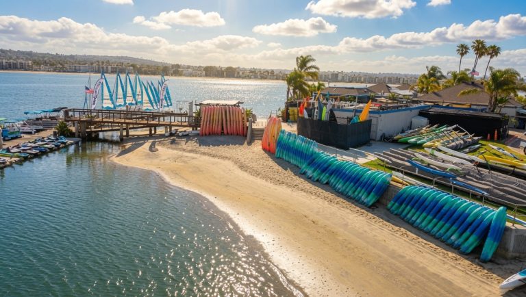
Make the map real
See Mission Bay from the water.
Choose the pace, bring your people, and launch from Mission Bay Sportcenter at Santa Clara Point.